I’ve been quiet for awhile, and the reason is pretty simple - not a lot of woodgas happening for me these days. I decided a couple years back to re-focus my energy on a different goal, getting a homestead set up and running. (I’m also working on the “get married and have kids” part… nothing to report yet.) Initial requirements are largely … a pile of cash. So, I worked a good paying job on the road for a couple years, installing grocery store fixtures. Now I’m back in town, working another decent job at one of my favorite businesses, Earth Tools (walk behind tractors, sales and service). The cash is ready, and I’ve been watching the market for about a year now.
Since it appears I may have finally found some land, I want to go back (briefly) and share the process so far.
I decided up front I wanted to live near my family, we are currently situated in Frankfort KY. North of here is a large area of empty rural land. In fact, on a map you can draw a triangle between Louisville, Lexington, and Cincinnati. The land in between is very rural, with good rainfall and a nice growing season, also plenty of trees and hills but also flat areas. The Kentucky River runs right up the middle of this section, and several large creeks feed into it.
Land around here goes for anywhere from 2-10K per acre, depending on the size and usability. Generally larger parcels are cheaper per acre, and smaller ones are likely to have a house already. The ideal (for me) range of 20-50 acres is oddly lacking. Lately I’ve been looking at the larger end of that scale, as much as 100 acres. More than that is cost prohibitive.
My research tools are as follows.
#1. Zillow. This is my “inbox” so to speak. I check all new properties on Zillow that fall in my criteria. I like it because their map interface is very easy to use, and you can save properties. There are limitations, and their data is not always accurate. But they will turn up every normal MLS listing out there, in one central spot, where you can sort by price, size, etc.
#2. Google Maps/Google Earth. My next step in land evaluation is to load the property into Google Maps, and run several checks:
- How far of a drive is it to Earth Tools (my job)?
- How far of a drive is it to Frankfort?
- Can I determine the boundaries (more on that below)?
- Is there running water, creek, river etc?
- How steep is it, are there flat areas?
- How close are the neighbors?
- Where would you build?
- Is it possibly a floodplain?
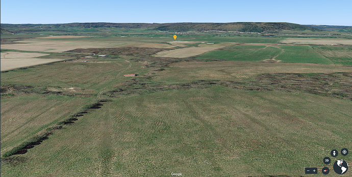
I can tell all of this from Google Maps and Google Earth. It’s creepy when it’s your own house, but incredibly useful for investigating land. “Let your fingers do the walking”… on steroids. And it’s free.
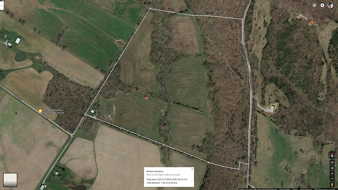
I measure land using this “one weird trick” I learned. Right click anywhere on Google Maps, and choose “Measure distance”. Then start clicking. It will place a pin anywhere you click, and if you select a whole area, it will tell you the land area you’ve selected, in square feet. Convert that to acres, and then adjust the boundaries until it matches the listing. Usually following fence lines is a safe bet, but it can get tricky. Still, it’s a good idea of how big a place is. Plus you can measure individual fields, flat areas, valleys, whatever you like; without needing a separate survey done.
#3. AcreValue. This is a recent addition to the toolbox, but a very useful one. I use it to find property boundaries, current owners, etc, as well as soil types! Also free.
#4 FEMA floodmaps. If the property is near water, I will check this to see if any of the land is 1% floodplain, and therefore needs flood insurance to build. This has a large bearing on the current property, which is mostly floodplain. I still think it’s workable, as I shall explain.
#5 Drive-by video. If a property gets this far along, I’ll swing by after work and film it from the road. This gives a better visual than I can get from Google Earth, plus a sense of scale, and some info on the road conditions getting in and out of it. Some eagle-eyed folks might have seen a property drive by or two on my channel briefly.
If I’m still interested after all this, I contact a realtor, friend of a friend and a naturalist, she’s very good with rural land.
So… just recently I found this place: https://www.zillow.com/homes/for_sale/Monterey-KY/2090778763_zpid/
80 acres, $250K. House, barn, 60 acres in bottomland and 20 in wooded hillside. 10 minutes from work, 25 from Frankfort. Down the street from two of my co-workers. About a mile from the Kentucky River, has two creeks on the property. The bottom is entirely in the floodplain, but the hill behind it is not. I can build at the base of that hill and stay elevated enough.
Did a walkaround last night with the realtor. The fields are pretty wet. Drainage will definitely need to be improved. However, water management has been a hobby of mine for years, and I know exactly how to fix it. The reward is incredibly fertile bottom land. I don’t intend to crop it, probably most will be rotational grazing or hay, possibly some small grain production, and the rest returned to woods in a controlled manner.
It’s certainly bigger than my immediate needs, but there will be room for the rest of my siblings to build and share it if they so choose. This will be a family venture, I’m not doing this entirely on my own, but I am taking the lead on it.
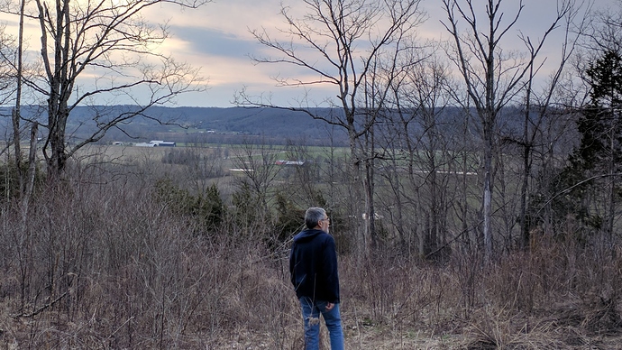
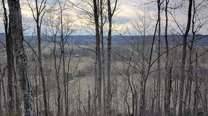
Here’s a 10 minute video walking up a logging road at the back of the property. Definitely a hike, but you can see a lot of the land from above, and the view at the top is awesome.
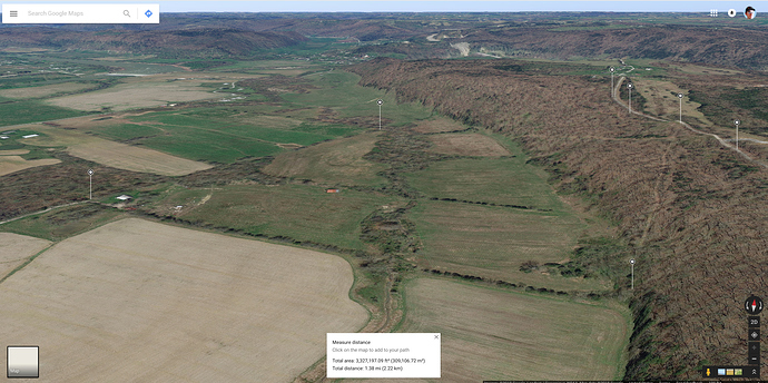
Google Earth link (Chrome browser only)
View from the top:
Satellite:
Google Earth approximate view from ridge, no trees:

